
Последняя версия
Версия
2.3.0
2.3.0
Апдейт
январь 18, 2025
январь 18, 2025
Разработчик
Esri
Esri
Категории
Инструменты
Инструменты
Платформы
Android Apps
Android Apps
Загрузки
0
0
Лицензия
Бесплатно
Бесплатно
Название пакета
com.esri.earth.phone
com.esri.earth.phone
Репорт
Сообщить о проблеме
Сообщить о проблеме
Подробнее о ArcGIS Earth
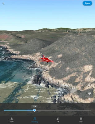
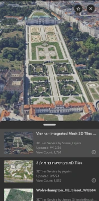
ArcGIS Earth transforms your mobile device into an interactive 3D globe for exploring geospatial data. Access authoritative organizational data, collect field data, perform measurements and exploratory analysis, and share insights with others. Whether you are online or offline, ArcGIS Earth puts the power of 3D visualization at your fingertips. Collaborate with key stakeholders to accelerate decision-making through a shared 3D perspective or digital twin of your data.
Key Features:
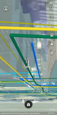
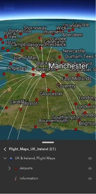
- View maps, GIS layers, and 3D content.
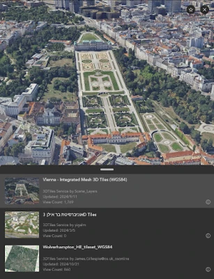
- Explore and visualize open 3D standards.
- Securely connect to your organizations ArcGIS Online or ArcGIS Enterprise portal.
- Search for places using world locator service or custom locator service.
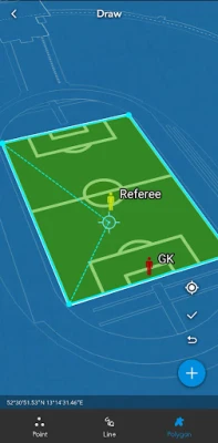
- Draw points, lines, and areas on an interactive 3D globe.
- Add notes and attach photos to drawings.
- Share drawings as KMZs or publish to ArcGIS Portal.
- Create and share tours using placemarks or geotagged photos.
- Conduct interactive 2D and 3D measurements.
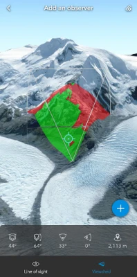
- Conduct 3D exploratory analysis like line of sight and viewshed.
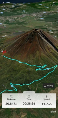
- Record GPS tracks and save as a KMZ or publish to ArcGIS Portal.
- Integrate with other device apps to enable 3D visualization in field workflows.
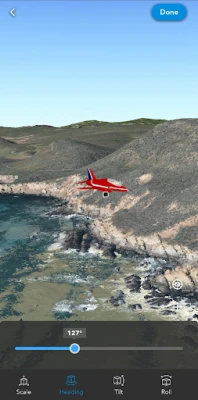
- Position 3D data on a surface to see it in Augmented Reality.
Supported Online Data Services: ArcGIS Map Service, Image Service, Feature Service, Scene Service, Web Maps, Web Scenes, 3D Tiles Hosted Service, and KML / KMZ.
Supported Offline Data: Mobile Scene Package (.mspk), KML and KMZ files (.kml and .kmz), Tile Packages (.tpk and .tpkx), Vector Tile Packages (.vtpk), Scene Layer Packages (.spk and .slpk), GeoPackage (.gpkg), 3D Tiles (.3tz), Raster Data (.img, .dt, .tif, .jp2, .ntf, .sid, .dt0…)
Note: An account is not required to browse public data on ArcGIS Online and ArcGIS Living Atlas of the World, the world's foremost collection of geospatial information.
Note: This app requires you to have a licensed ArcGIS user type to access organizational content and services.
Оцените приложение
Добавить комментарий и отзыв
Отзывы пользователей
Основано на 0 reviews
Отзывов пока не добавлено.
Комментарии не будут допущены к публикации, если они являются спамом, оскорбительными, не по теме, содержат ненормативную лексику, содержат личные выпады или разжигают ненависть любого рода.
Ещё »


Популярные приложения!

MarinaСорокин Дмитрий Олегович (@sorydima)

Marina for HUAWEIСорокин Дмитрий Олегович (@sorydima)

MarinaСорокин Дмитрий Олегович (@sorydima)

REChain ®️ 🪐Сорокин Дмитрий Олегович (@sorydima)

Katya ® 👽Сорокин Дмитрий Олегович (@sorydima)

Катя ® 👽Сорокин Дмитрий Олегович (@sorydima)

🎨 Катерина - Профессионал. 🙆Сорокин Дмитрий Олегович (@sorydima)

Катя ® 👽Сорокин Дмитрий Олегович (@sorydima)

REChain ®️ 🪐Сорокин Дмитрий Олегович (@sorydima)

REChain ®️ 🪐Сорокин Дмитрий Олегович (@sorydima)
Ещё »


Выбор редактора

PWA Modus PoS Pro SaaSСорокин Дмитрий Олегович (@sorydima)

Modus PoS Pro SaaSСорокин Дмитрий Олегович (@sorydima)

Marina for HUAWEIСорокин Дмитрий Олегович (@sorydima)

MarinaСорокин Дмитрий Олегович (@sorydima)

Катя ® 👽Сорокин Дмитрий Олегович (@sorydima)

Темпо (Tap Tempo)Сорокин Дмитрий Олегович (@sorydima)

Поросёночек для специалиста!Сорокин Дмитрий Олегович

Поросёночек для хозяинаСорокин Дмитрий Олегович (@sorydima)

Поросёночек для специалиста!Сорокин Дмитрий Олегович (@sorydima)

Delus ® 🐾REChain Network Solutions




 Web PWA
 HARMONY OS
 ОС Аврора
 Polkadot
 Ethereum
 BNB
BNB Base Blockchain
 Polygon
 Gnosis
 Arbitrum
 Linea
Linea Moonbeam
 Aptos
Aptos Solana