
Последняя версия
Версия
1.15.1
1.15.1
Апдейт
январь 11, 2025
январь 11, 2025
Разработчик
CalTopo LLC
CalTopo LLC
Категории
Путешествия и местная жизнь
Путешествия и местная жизнь
Платформы
Android Apps
Android Apps
Загрузки
0
0
Лицензия
Бесплатно
Бесплатно
Название пакета
com.caltopo.android
com.caltopo.android
Репорт
Сообщить о проблеме
Сообщить о проблеме
Подробнее о CalTopo
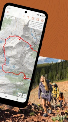
The best backcountry mapping tool on the web is now available on Android.
Cloud Sync
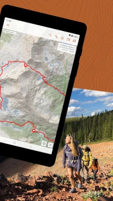
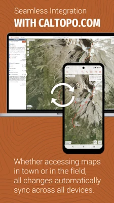
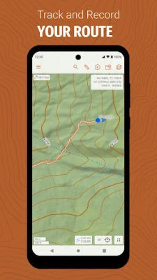
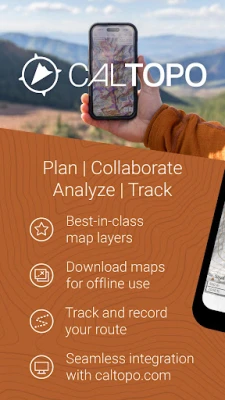
The CalTopo app integrates with your existing caltopo.com account, and edits sync between the two in seconds. Plan your trip using CalTopo's best-in-class mapping tools and then seamlessly transition to your phone. Once in the field, sync your GPS track back to caltopo.com in real time, or drop markers and instantly share them with friends.
Amazing Maps
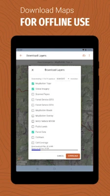
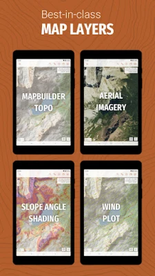
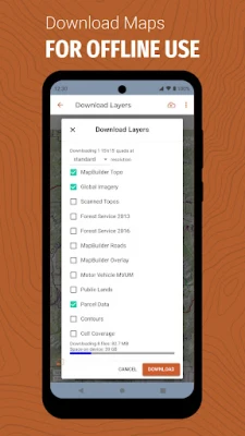
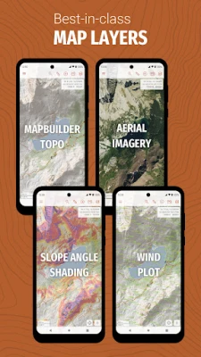
Access CalTopo layers not available elsewhere, including the MapBuilder series, land management, sun exposure, fire activity and custom terrain shading. Pre-packaged map files (subscription required) make for speedy offline downloads and simplified data management. An elevation data layer supports measuring profiles and point elevations, even when offline.
Real-Time Data
NOAA weather forecast visualizations and MODIS satellite imagery aid in-field decision making. Coming soon: SNOTEL, weather stations, streamflows and forecast grid data points.
Оцените приложение
Добавить комментарий и отзыв
Отзывы пользователей
Основано на 0 reviews
Отзывов пока не добавлено.
Комментарии не будут допущены к публикации, если они являются спамом, оскорбительными, не по теме, содержат ненормативную лексику, содержат личные выпады или разжигают ненависть любого рода.
Ещё »


Популярные приложения!

MarinaСорокин Дмитрий Олегович (@sorydima)

Marina for HUAWEIСорокин Дмитрий Олегович (@sorydima)

MarinaСорокин Дмитрий Олегович (@sorydima)

REChain ®️ 🪐Сорокин Дмитрий Олегович (@sorydima)

Katya ® 👽Сорокин Дмитрий Олегович (@sorydima)

Катя ® 👽Сорокин Дмитрий Олегович (@sorydima)

🎨 Катерина - Профессионал. 🙆Сорокин Дмитрий Олегович (@sorydima)

Катя ® 👽Сорокин Дмитрий Олегович (@sorydima)

REChain ®️ 🪐Сорокин Дмитрий Олегович (@sorydima)

REChain ®️ 🪐Сорокин Дмитрий Олегович (@sorydima)
Ещё »


Выбор редактора

PWA Modus PoS Pro SaaSСорокин Дмитрий Олегович (@sorydima)

Modus PoS Pro SaaSСорокин Дмитрий Олегович (@sorydima)

Marina for HUAWEIСорокин Дмитрий Олегович (@sorydima)

MarinaСорокин Дмитрий Олегович (@sorydima)

Катя ® 👽Сорокин Дмитрий Олегович (@sorydima)

Темпо (Tap Tempo)Сорокин Дмитрий Олегович (@sorydima)

Поросёночек для специалиста!Сорокин Дмитрий Олегович

Поросёночек для хозяинаСорокин Дмитрий Олегович (@sorydima)

Поросёночек для специалиста!Сорокин Дмитрий Олегович (@sorydima)

Delus ® 🐾REChain Network Solutions




![Navigation [Huawei watches]](https://rechain.ru/images/17365476126277468.webp)
 Web PWA
 HARMONY OS
 ОС Аврора
 Polkadot
 Ethereum
 BNB
BNB Base Blockchain
 Polygon
 Gnosis
 Arbitrum
 Linea
Linea Moonbeam
 Aptos
Aptos Solana